
NWS: Winter storm brings more sleet than snow to East End

Update (noon): Supervisor Sean Walter issued a travel advisory late Tuesday morning urging drivers to reduce speed if they have to travel today. Roads are slush covered, the advisory notes, and should improve with additional rain and higher temperatures.
“Use extreme caution if venturing out tonight or tomorrow morning as roads and walkways will become icy as temperatures dip back down below freezing,” the advisory says.
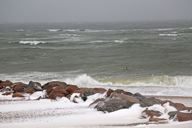
Minor to moderate coastal flooding is expected during the afternoon’s high tide along Peconic Bay and Long Island Sound. A coastal flood warning is in effect until 4 p.m.
Precipitation is expected to continue until about 8 p.m. tonight and could turn back into snow later tonight.
Update (8:30 a.m.): The National Weather Service canceled the winter storm warning this morning as the storm striking the northeast brings more sleet than snow to the East End.
The NWS said parts of the East End may see as little as 4 inches of snow in the end, after initial warnings earlier in the week had said between 12 and 18 inches were possible. Strong winds and gusts up to 55 mph may still be expected into the afternoon, the NWS said.
Original Story: The late-winter storm striking the tri-state area Tuesday is expected to spare the East End the worst, but dangerous conditions are still expected with high winds and blizzard-like conditions.
The National Weather Service’s most recent winter storm warning for the East End warns of heavy snow and sleet and snow accumulations of 4 to 12 inches. Original predictions had called for between 12 and 18 inches. The heaviest snow is now expected to hit southern Connecticut, New York City and the Hudson Valley areas where as much as two feet of snow may fall. Parts of western Suffolk County along the north shore are still facing a blizzard watch, but most of the county is now in a winter storm warning as the storm made landfall early Tuesday tracking more to the west, according to the NWS.
The storm will bring a wintry mix as snow changes to sleet and rain sometime in the afternoon. The precipitation is expected to change back to all snow before the end of the evening, the NWS said.
Gusts of wind up to 55 mph are still expected with more sustained winds of 30 to 40 mph, leaving the possibility of downed power lines. No problems were reported by PSEG Long Island as of 6 a.m. today.
Visibility will be one-quarter of a mile or less at times, creating dangerous travel conditions.
Riverhead Town Supervisor Sean Walter declared a winter storm event in Riverhead so residents should not have cars parked on the street to help with snow removal. The supervisor warned residents to avoid driving today and cautioned some secondary roads might be impassable, particularly the north-south roads adjacent to open fields.
Schools all across the East End closed today. Governor Andrew Cuomo declared a state of emergency across the state that began at midnight. All non-essential state employees, except for in six counties, were told to not report to work today.
County Executive Steve Bellone, in a conference call Monday afternoon, encouraged residents to avoid driving if possible. Strong wind combined with heavy snow will likely create white-out conditions in the morning that make it difficult even for plows to navigate, Mr. Bellone said.
“It’s very important that people are not traveling tomorrow unless they absolutely have to,” he said. “The road conditions, I would describe, based on the prediction of the storm, to be treacherous.”
The Suffolk County website has been updated with public information for emergencies to provide updates and contact information for residents.
A coastal flood warning also remains in effect into the early afternoon tidal cycle, the NWS said. Minor to moderate coastal flooding is expected around high tides along the eastern bays of Long Island and the Atlantic Ocean beaches. High tide in Riverhead is 2:07 p.m. and moderate flooding is expected. In Orient, high tide is 12:25 p.m. and minor flooding is expected, the NWS said.
Photo credit: Grant Parpan.


