
Hurricane outlook: When will the next big storm hit?
No storm has hit the East End with the same power since the “Long Island Express” hurricane smashed into the area 75 years ago with wind gusts as high as 186 mph and storm tides of 12 to 15 feet.
But weather experts say it’s not a matter of if another big storm will hit our region, but when.
“It’s as close to a guarantee as a scientist is willing to admit,” said Scott Mandia, a professor of physical sciences at Suffolk County Community College.
And while 2013’s hurricane season — which began in June — has been quiet so far with no major hurricanes developing, meteorologists say the season could still produce violent storms before it ends in late November.
“We’re only at halftime in the football game,” said Dennis Feltgen, meteorologist and spokesman for National Hurricane Center in Miami, Fla.
Special Report: Remembering the ‘L.I. Express hurricane of 1938’
In May, the National Oceanic and Atmospheric Association predicted an “active to extremely active” season this year, with between 13 and 20 named storms with winds above 39 mph and seven to 11 hurricanes — well above the seasonal average.
Though there have been nine named tropical storms so far this year, only two hurricanes have formed, Mr. Feltgen said.
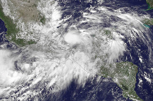
The first, Hurricane Humberto, came to life off the coast of Africa last week. A second hurricane, Ingrid, dissipated after it hit Mexico over the weekend.
“Statistically, by the time we reach [Sept. 21] we should have had at least four hurricanes and one major hurricane,” Mr. Feltgen said.
Hurricanes have been slow to form this year due to a large mass of dry, stable air sitting over the eastern Atlantic off the coast of Africa, which makes it hard for clouds to grow, he said. At least three tropical storms this year — Chantal, Dorian and Eric — began in the African tropics but were snuffed out by dry air.
The hurricane season is half over in mid-September and the peak of the season is winding down.
“But that doesn’t mean by any stretch of the imagination we can’t catch up in a hurry,” Mr. Feltgen said. Last year, Hurricane Sandy was a late-season storm that went on to cause more than $64 billion in damage and knock out power in New York City and across Long Island.
We are now in an “active hurricane cycle” that began in the mid-1990s, Mr. Feltgen said, noting that such cycles generally last 20 to 40 years.
But in the long run, experts say, the North Fork may see fewer storms than in previous years due to global warming. Mr. Mandia said models show that climate change may lead to more El Niño seasons, which cause stronger upper-level trade winds in the Atlantic that disrupt hurricane formation.
However, when hurricanes do make it to our area, he said, they will likely be stronger. Hurricanes are fueled by tropical waters and become more powerful by drawing moisture from the warm seas up into the clouds.
A warmer climate means warmer sea temperatures, Mr. Mandia said. When Hurricane Sandy chugged up the coast, the water was one degree warmer than normal because of climate change, he said.
Sandy would have caused damage across Long Island even without global warming, but Mr. Mandia said the hurricane was “definitely made worse” by the warmer water.
Rising sea levels and denser populations on the North Fork also mean storm surges will affect more people. The worst-case surge from a category 1 storm would turn Orient into an island by cutting off Route 25 near the causeway, similar to what happened during Hurricane Sandy, according to a surge inundation map by the New York State Office of Emergency Management. In a Category 2 storm, parts of Greenport would also be flooded and cut off from the rest of the town and in a Category 3 hurricane — the same category as the Long Island Express — the village would be submerged, the chart shows. Southern sections of Shelter Island would disappear under the waves while farther west, residences around Peconic Bay in Flanders, Jamesport, Aquebogue and Riverhead would be completely swamped.
“We’re only making ourselves more like sitting ducks if we continue to warm the planet and cause seawaters to rise,” Mr. Mandia said.
He advised residents to be prepared to live without modern conveniences like power or gas for a week or two in the event of a powerful storm.
While those inland will not be affected by the higher storm tides, those who enjoy life along the coast will suffer damage when the next Long Island Express hits.
“I take my kids to the beach and I see the mansions on Dune Road,” Mr. Mandia said. “I look at all those and I think, ‘Borrowed time, honey. Borrowed time.’ ”


