
Forecasters: Spring will kick off with a nor’easter and more snow

The spring equinox may begin Tuesday, but that doesn’t mean the area is free of winter weather.
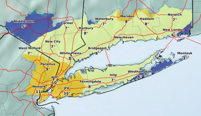
The latest nor’easter could bring six to eight inches of snow to the North Fork late Tuesday night into Wednesday night, according to the latest forecast models, Jay Engle, a meteorologist at the National Weather Service office in Upton, said.
A winter storm watch is in effect from late Tuesday through late Wednesday night for all of Long Island.
This is the fourth nor’easter in recent weeks.
Heavy, wet snow is possible and motorists should plan on difficult travel conditions during the evening commute Wednesday, the NWS said in the winter storm watch that was issued Monday afternoon.
The latest forecast calls for a rain/snow mixture Tuesday night into Wednesday, but “it’s going to come down pretty hard” on Wednesday night up to midnight,” Mr. Engle said.
The South Fork will see one to two inches less, with Montauk getting three to four inches.


